Tuesday 29 March 2011

Yipeeeee - more daylight!!

Now that the clocks have changed there should be enough light for more fun and games; training runs before work and climbing after work!!!

Yesterday evening I ran 10k along the road from my house to the Clachaig Pub (sadly not stopping for a pint), but taking in a detour on the return through some woodland trails (signposted Signal Rock). I ran round the south shore of a pretty wee lochan that I have never even noticed before [grid ref 123570]!

This morning, Ben and I got an early start and decided to run up the Pap of Glencoe (Sgorr na Ciche, 742m) before work.....

View from the Pap this morning


We started in the dark but soon the sun was up and it was a lovely still morning. With all this extra daylight, maybe it's time for me to step up the training.....

Monday 28 March 2011

Training Weekend 26/27th March

An Teallach Traverse
This weekend my partner, Ben, and I walked the An Teallach Traverse. We started the walk from Dundonnell, taking a track leaving the road at grid ref 092878 and tackled the traverse anti-clockwise.

The route had a distance of 17.5km (11 miles) and 1497m ascent. The walk involves considerable scrambling (mainly across the Pinnacles) and took us 8 hours in total.

We had some glimpses of sunshine and blue sky in the early morning on Saturday, so were hoping for a sunny day for this classic ridge traverse. Eventually, we were duly served up another typical Scottish day, complete with drizzle and general clagginess!

A meandering track wanders up the Meall Garbh ridge, eventually bringing you across some strange pancake-like stones covering a set of terraces at the head of the coire on your left. A purely geological phenomenon, they give the ground a paved appearance.


Bidean a Ghlas Thuill
From here we skirted Sron a Choire to find a nice (first) lunch spot in the col north of Bidein a Ghlas Thuill. From here the summit of the nearby Munro looms above you, a rocky jumble with a maze of small tracks leading up to its trig point at 1062m. Sadly there were no views to had this day and we descended SW to a col at 912m before pulling up to the summit of Sgurr Fiona (1060m). This is where the fun really begins and as you descend the SE ridge of this Munro, you get a taster of what is to come...


Looming ahead are the impressive overhanging Pinnacles and Lord Berkely's Seat (an usual sofa-shaped rock jutting out from the precipice, with a 350m drop below your feet!!) The sandstone rock is brilliant and the scrambling superb. The exposure is extreme enough to give even the most carefree the heebie-jeebies! 
Overhanging Pinnacles
from above


Sitting on top of the Pinnacles!

Sitting on the very top of the Pinnacles is a thrilling experience (although I wasn't keen to stick around up there too long!) Following this initial section, the scrambling over Corrag Bhuide is more broken up. There is a lower level track which misses out most of the difficulties but if you can stick to the crest and find a plentitude of excellent bouldering problems of varying levels of trickiness. The Torridonian sandstone gives rise to usual pancake-stacks and seemingly (or really) unstable boulders in precarious places!


At the end of the Corrag Bhuide ridge things end abruptly with a steep crag, which would be a pretty serious downclimb. We back-tracked a little here and dropped off the ridge to the south and down to a track visible below.  After such sustained scrambling, it is a considerable pull up to the summit of Cadha Gobhlach (960m), just when you were hoping for some rest from the hardwork! The height-gain required to reach the final summit (Sail Liath, 954m) is less than the previous one and this top represents the end of the traverse. From here you can see an impressive quartzite faultline to the north, over Loch Toll an Lochain. Howver, it is the view to the south which is truly breathtaking. A rare glimpse of the spectacular Fisherfield Munros tempts the mind to think of the next epic undertaking......

Beinn Dearg Mor and Gleann na Muice
in the background
From here Ben and I descended the broad bouldery ridge SE from the summit, traversing in a northerly direction as we went, to eventually pick up the track at the bottom. This rocky (but in places boggy) track eventually joins a more major track down through the stunning Gleann Chaorach and passed a picturesque waterfall before reaching the A832 at Corrie Hallie.

A long and tedious 5km walk along the road back to the car is now ahead.... that is unless some very kind fellow-walker drives by and offers you a lift!!!

An Tellach is an amazing hill day, a fantastic scramble and the perfect all-rounder. More managable than the Cuillin ridge Traverse but with all the same exposure and quality of scenery. I look forward to heading back up there to try it again (in the dry/sunshine) and to investigate the remote Fisherfield Hills.....

Yipeeee!!!
On sunday we tried to climb in Gairloch. We manged one short route but then got rained-off (or drizzled off!!!)

The Ewe Slab (Vs 4c)


Friday 25 March 2011

Kit testing - First thoughts.....

I have now used most of the kit that has been donated by sponsors in different ways; walking, running and climbing. I haven't quite put them throught their paces yet but here are some of my first observations....

Arcteryx Phase AR Zip Neck baselayer:
When i'm wearing this baselayer I simply never notice it! When walking up steep hills on warm days it doesn't seem to get wet and sweaty at all.

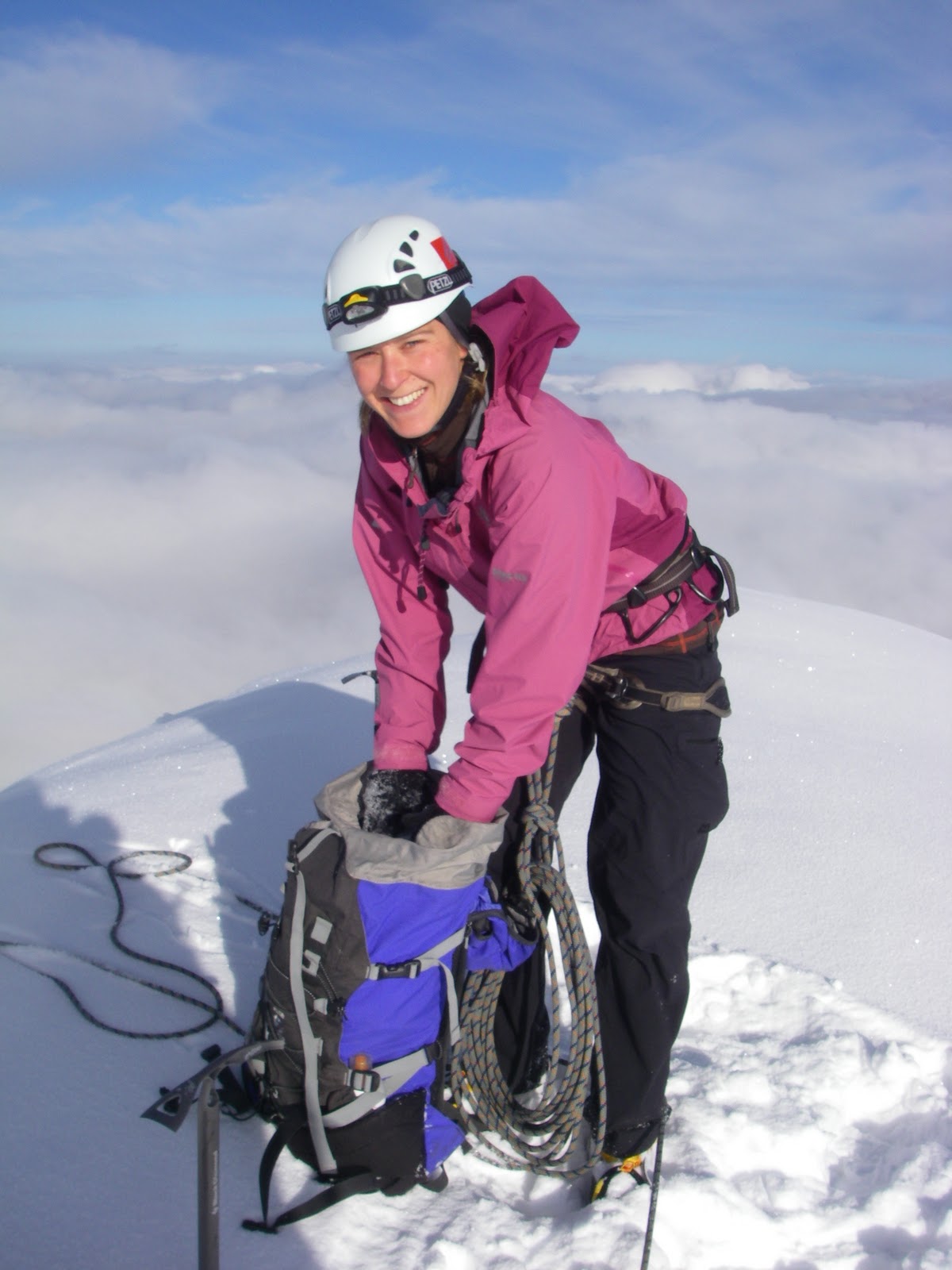
The zip neck allows you extra ventilation when you need it on the way up, yet it feels good to zip it up fully once you get higher and into the wind. The cut is also perfect (for me anyway!) It has nice long arms (so that you don't get breezy wrists) and a nice long body (so that it doesn't ride-up above your pack's waist strap and give you a drafty mid-riff). When winter climbing I have found it is plenty long enough to tuck-into my fleece leggings without it constantly pulling out when I reach up. I felt nice and warm.

I have to confess to using this baselayer over and over again without washing it. I just give it a good airing! It dries out really quickly and doens't smell bad, like many baselayers do - brilliant for long weekends away, for camping or for people who just can't be bothered with chores!!

The fabric is quite thick, which gives it its warmth for activities in cold weather but it is surprisingly breathable. Also the cut and fabric are very comfortable against the skin (there are no itchy labels or irritating seams).

Everyone I have spoken to who has tried the Arcteryx Phase AR is singing its praises. This baselayer does exactly what a baselayer should and (like most Arcteryx kit), it is so flattering you'll want to wear it out to the pub too!

Get yours at Joe Browns!!!  http://www.joe-brown.com/ 01286 870327


Mountain Equipment Firefox II Jacket:
So far, I have worn this jacket walking, running and climbing. In my view, there is a very definite niche, where this jacket totally excels; summer/alpine mountaineering and hillwalking - making it perfect for the UK Big 3 Challenge!

WINTER: Because it's winter at the moment, I have possibly been taking this jacket somewhat outside of its comfort zone; scottish winter walking and climbing. Despite being really light, it is also surprisingly durable (it has even resisted a few snags from my ice axe, when stashing one down my back - ooops)! The jacket is cut really high at the neck and so gives good protection from rain and snow when the weather is gnarly. The adjustable hood also performs well, staying-put in even the most difficult winds. The same is true of the peak, which is stiff enough to keep its shape and not collapse.

I was pleased to find that the jacket is cut longer at the back than the front. This reduces that horrible feeling when your jacket rides-up unnoticed over the course of the day leaving you exposing your baselayer or bare skin to the elements (brrrrrr!) The hem draw-cord helps it stay-put too.

The cuffs open REALLY wide, allowing you to get massize winter gloves tucked in easily. This is a brilliant feature and saves you a lot of time fiddling and poking about. Why don't more jackets have this???

I did find however, that the velcro wrist-straps and cord adjustments (hem and hood) are very lightweight and a bit too fiddly for winter gloves. The velco strip on the wrist is pretty narrow and so it sometimes works its way open. Having said this, I was really surprised by how well it performed overall in Scottish Winter.

Strangely, the zips on the chest pockets are towards the outside of the body (rather than on the inside, either side of the main zip in the middle). The result for me is a bit more fumbling and dropping of things when trying to get in and out (especially in big gloves). However, I suspect this is just a personal preference!

RUNNING: This jacket is sooOOoo breathable that you simply don't get that feeling of rivulets of sweat running down inside your jacket. When running it is so light that it makes you feel fresh and swift even when you're flagging! The pit zips help add ventilation where you need it and are nice and long, so that you can have them open wide for a very breezy feeling, or part-way for less dramtic increases in breathability. The cut is not close-fitted like a running jacket but  is instead loose enough to fit a fleece mid-layer or two underneath should you need it. Having said this, the Active Goretex is awesome and more than copes with extra sweating caused by running about the place!

WALKING/SUMMER MOUNTAINEERING: This is where this jacket starts to shine and all the features mentioned above come into perfect harmony: for summer mountaineering/alpine/walking there is an ideal balance between weight-saving features and durability. It gives you great protection from the rain and wind, while allowing you to move freely, layer-up and stay fresh. Plus if it is dry (unlikely), you won't even notice that it's in your pack!!

Contact Nevisport for more information: http://www.nevisport.com/ or call 01397 704921

Sunday 20 March 2011

Weekend 19/20th March

Buachaille Etive Mòr
This weekend I decided to put both my arms and my legs through a workout for a change and went winter-climbing.

On Saturday, my friend Elise and I climbed a route on Buachaille Etive Mòr called D-Gully Buttress. The route is a winter grade III,4 and feels quite long, because when you reach the top, you have to cross over to the neighbouring ridge (Curved Ridge) and finish up this before you reach the top of the mountain. Overall we climbed 9 pitches that day and then walked back to the car via the north ridge (west of Coire na Tulaich). It felt like a long day but the route was a really enjoyable and had varied climbing with a few interesting cruxes.

On Sunday, I walked the Ballachullish Horseshoe on my own. I started my day at 8:45am by scrambling up the East-North-East ridge of Sgorr Bhan (the so-called School-House Ridge) and finished by dropping off the horseshoe into the forsest of Glenachullish (3pm). The route was 12.2km in length, with 1420m of ascent. The weather was claggy, rainy, windy and generally not great! This added to the duration of the day (I had to keep checking my map and also the snow slopes to check they were safe enough to walk on).

Gaining the summit of Sgorr Ban was fairly staright forward due to good firm neve underfoot and crampon tracks from walkers the previous day. Tackling the ridge from here to the summit of Sgorr Dhearg (1024m) was rather more testing.....
Sgorr Dhearg on a nicer day!
[Inspire Mountaineering]
In white-out conditions I was wary of a potential cornice on the northern slope and so dropped off the southern side slightly, where (surprisingly) the top 4 inches was quite firm windslab, which sheared-off easily. Therefore I moved up to the very crest of the ridge, where fortunately the coverage of snow was thinner and had also been tramped into a nice firm track by previous passers-by.

Sgorr Dhonuill on a nicer day!
[Inspire Mountaineering]
I then dropped quickly to the col at 757m before starting the slog upto Sgorr Donhuill (1001m). I didn't expect the summit ridge to be so impressive. It is rather narrow and bouldery, with steep crags dropping away on your right.

From here the ridge loses much of its charm (in my view) and the rest of the horseshoe is made up of endless knolls, spurs and smaller summits. This sunday there was a lot of deep, drifted snow which was old and soft. This meant that progress became very slow with me constantly sinking up to my thighs! Very tiring.

Eventually I had enough and dropped of the ridge (033572) and managed some excellent "bum-sliding" in my waterproof trousers, which helped speed up the descent considerably!! I was expecting a horrible battle with thickly-forested trees to reach the track in Glenachullish but actually it worked out rather well, with only about 200m-worth of trees to pick through before reaching the huge track (yeeha!) and a straight forward walk out to the car park.

An excellent training-day but most definitely a slog. If I did this route again, I would try and descend to Glenachullish much earlier after Sgorr Donhuill and try and miss out some of the miserable terrain on the western most part of the horseshoe!

Thursday 17 March 2011

Outside Edge donate kit for testing

Thank you very much to Outside Edge in Oban, who have very generously donated a women's Montane Lite-Speed windproof for testing during training and the challenge in May. Being made from the highest quality Pertex Microlight (rip-stop), the jacket weighs in at 150g. The Lite-Speed is completely windproof and quick drying, with an apparently durable water repellency (DWR). It also packs down into a tiny weeeny stuff sack of its own.

I have previously only used a Rab smock windtop without a hood, so i'm interested to see how the Pertex Microlight fabric compares and also whether the front zip and hood prove useful on the hill.

Please see the 'KIT' tab for more details on this item and for performance reviews (...in due course!)

Thanks again to Dave Bleazard!
Visit Outside Edge in Oban (6 MacGregor Court) or call: 01631 566617  
http://www.outsideedgeoban.com/

Sunday 13 March 2011

Weekend March 12/13th

This weekend Ben and I had family to visit us in Glencoe, which meant I was lucky enough to have a weekend off from training! Having said this, we still got out and about in the snow. On Saturday we walked up Beinn na Lap (935m) via the SW ridge, from Corrour Station in some pretty wild wind and deep snow.
 
Summit cairn group shot!
On Sunday the plan was to walk part of the West Highland Way from Glencoe to Kinlochleven, via the Devil's staircase but in practice the snow was WAY too deep and we made very slow progress!

In the end turned back in favour of coffee and cake!

Later we decided to burn off a few of these calories by ploughing our way up to the telemast at the summit of am Meall (414m) before dark. The snow was VERY wet and thigh-deep near the top but we got some views of the Pap of Glencoe and Sgorr Ban looking bleak in the fading light.


Friday 11 March 2011

Distance and Ascent

Using Memory Map, paper maps, reference books and a bit of guesswork, I have come up with the following table of stats for the distance and ascent of each day of my UK Big 3 Challenge (gulp!!!)

Round
Leg/Day
Distance (miles)
Ascent
(metres)
PBR
1
19
2800
PBR
2
15
2200
PBR
3
14
1600
PBR
4
13
2100
BGR
1
21
2740
BGR
2
15
1600
BGR
3
14
1800
BGR
4
16
1981
CRR
1
19
3590
CRR
2
22
2672
CRR
3
19
2900
TOTAL

187
25,983

These stats represent my legs (i.e. how I have divided the rounds up into days), rather than the classic legs associated with the 24h running challenges. These values are also very approximate and could vary considerably. However, it is a good guideline for what I can expect.

Looks like the mamores are going to take the prize for hardest day (19 miles, 3590m)!!!

Monday 7 March 2011

Training Weekend 5/6th March

This weekend Arlene and I headed to the Lake District to investigate the longest and hardest legs of the Bob Graham Round.


DAY 1: Dunmail Raise to Wasdale. Total length 27.5km (17 miles), with 2046m ascent (and descent 2203m). Dunmail Raise to Wasdale.

Pike O'Stickle towards Harrison Stickle
After dropping the car at Honister Slate Mine on Friday night, we got a taxi to the Keswick Youth Hostel. On Saturday morning we caught another taxi to Dunmail Raise to start our walk (at 7:30am). After some apprehension about the slog up to Steel Fell from Dunmail Raise, it really wasn't as bad as we were expecting. The day started well and we enjoyed ticking off Steel Fell and then Calf Crag, as both are relatively low peaks. From here we decided to follow Mere Beck to the head of the river before aiming for Sergeant Man. By this time however, the clag had settled in and the visibility had become very poor (only about 10m).

High Raise
We then had some difficulty finding the summit of Sergeant Man but after much pacing, circling and shivering, we finally made it to the summit. From here we struck out to High Raise, disappointed that we would not see the infamous view from the summit (762m). As we headed south from here, towards Thunacar Knott, I realised that I had left my poles on the summit of High Raise. After reversing the last 500m and collecting the poles, we started to realise that we had wasted quite a lot of time on this early section of the walk!


Thunacar Knott
We then proceeded to walk SE from Thunacar Knott through craggy ground and made a quick scramble up the rock step of Harrison Stickle. Dropping through flatter, boggy ground, the cloud started to clear (coming and going), giving us a sudden view of Pike O'Stickle. We were surprised that there is actually a sort of staircase up the side of this summit!! The last 10m to the top is a fun little scramble, yielding a cracking view back to Harrison Stickle.

Towards Harrison Stickle
 From here we descended quickly to Martcrag Moor to try out the shortcut on the Bob Graham map (up a rocky terrace to the col before Black Crags). Somehow however, we missed the traverse and ended up climbing too vertically, ending up on the ridge a bit further to the right (NE). From here we followed the rough ridge to Rosset Pike near the far end. The next section is a cheeky scrabble weaving through chunky scree, boulders and crags (Hanging Knotts). At the top of the crags there is a cairn at 866m and a short distance to our 9th summit, Bowfell at 903m. This summit was busy, so we stopped out of the wind to have a late sandwhich (3pm!)

In the improving weather it was a relief to be able to put the compass away and head for peaks as they appeared on the skyline ahead. The ascent up Esk Pike passed almost unnoticed and we soon felt like we were ticking summits more quickly.

The highest peak in England!
 As the afternoon closed in we visited the flat topped Great End (907m), the rocky pile of Ill Crag (930m) and the jumble of rocks Broad Crag (934m), before we found ourselves on the NE ridge of Scafell Pike (977m). Arlene had never been up this famous top before, so it was a great treat for her that we actually had a view from the summit.


With the final peak approaching (Scafell), I started thinking about the easy rock climb Broad Stand that stood in our way. I had packed my rock shoes in my bag with the vague idea of soloing the route while Arlene walked round. I gave it a try but with the crux sopping wet, it took me a long time to work out alternative moves (avoiding obvious but slimy footholds). Finally I pulled over and made my way up the scramble above.
    
Broad Stand
  

Broad Stand in context


On the summit (964m) I waited for Arlene to appear. As more and more time passed we both wished we had made a more detailed plan for meeting up! As it became dark we managed to narrowly miss each other; with Arlene on her way up and me on my way down to look for her! I then headed down towards Wasdale Head from the col at Mickledore (hoping to find phone reception) while Arlene waited for me on the summit (bless her!) Finally I caught sight of her headtorch (descending via Green How) and we were reunited at the bottom at 9pm!! That evening we laughed about our crazy epic over a pint in the Wasdale Head Inn! 

DAY 2: Wasdale to Honister. Total length 18.6km (11.5 miles), with 2151m ascent (and descent 1873m).


This is a fantastic day out in good visibility because you can see the whole route stretching out ahead/behind you...Brilliant.

Today the weather was fantastic and we enjoyed sunshine as we struggled up the steep side of Yewbarrow and out of the Wasdale Head valley. From Yewbarrow (628m) there is a great little rocky traverse which enables you to drop quickly and easily to the low col at Dore Head (486m). It felt a total tragedy to lose the height just gained ascending Yewbarrow, only to be faced with the huge Red Pike (828m) in front of you! This was tempered by a great view round the horseshoe all the way to Kirk Fell.
 
 A bend in the wall on the north edge of Scoat Fell marks the beginning of the spur towards Steeple (849m). A striking feature with an exposed but easy scramble; this is a fab little top. It is surrounded by interesting rocky ridges and gullies. Steeple was definitely my favourite tick on this leg! Following the ridge eastwards, we scrabbled over boulders down into Windy Gap. The pull up on to Pillar from here is short but sweet, giving way to a broad flat summit with panoramic views.

Kirk Fell and Great Gable


Pillar
The next stretch was an enjoyable and easy angled (mostly) descent down to another low col at Black Sail Pass (542m). From this col, any route up the awesome Kirk Fell looked all but impossible. We followed the track upwards, weaving through fence posts, then drifting left to finish up a steep red-rock gully towards the top (this would have been very loose if it wasn't frozen!) The actual summit cairn was still a long way off though and as we walked, we looked ahead, to the Great Gable growing before our very eyes!

Great Gable

We tried to stay positive as we dropped from Kirk Fell summit (802m) down to Beck Head col (620m), with the last big climb up Great Gable (899m)just ahead . The zigzagging path is good but soon gives way to scrambling up steep piles of boulders towards the top. At this point all the hard work for this leg of the BGR is behind you, as all the remaining tops are lower. A short but steep drop-off then brings you to a narrow col between Great Gable and Green Gable, and a red slope rises up ahead.   

It was massively satisfying to look back and up at the peaks we had come from, knowing we were on the homeward stretch. An easy walk lay ahead to Brandreth (one cairn amoungst several, at a very similar height!), then on to a small rocky outcrop called Grey Knotts (697m).

We could see the road below as we descended grassy bogs to the left of craggy ground. We popped out in the Honister Slate mine, relieved to see that the car was where we had left it!!

The ascent on this leg of the BGR is HUGE and it is this that makes it seem so much harder than you would expect from its total length. Nevertheless, Arlene and I had a perfect day on some of the most interesting fells the Lakes has to offer.

Thursday 3 March 2011

Media Frenzy!!!

This week's copy of the Oban times (Lochaber Edition) features an article on the UK Big 3 Challenge (Thursday 3rd March edition). Complete with big claims and large photographs it is really quite embarrassing (blush blush) but great for raising the profile of the challenge and the charities I am supporting! 


Please also seee the following link for a Water Aid news article:
http://www.wateraid.org/uk/get_involved/events/event_news/9592.asp